DSCOVR was launched toward L-1 on February 11, 2015 and obtained its L-1 orbit in early June of 2016. The first month in the planned orbit about L-1 was devoted to stabilizing the spacecraft operations, initial calibration, and instrument checkout. Earth data was also obtained, but there were interruptions for lunar calibration and other check-out operations.
After the first month, the operation of DSCOVR went into a regular schedule. For EPIC, this means approximately 20 images every, 105 minutes in the Northern Hemisphere summer and every 80 minutes in winter to conform to the available telemetry rate of approximately 5 hours of downlink time at Wallops Island, Virginia. The official life time of this mission is two years. There is enough onboard fuel for 5 years.
Because of the unstable nature of the L-1 orbit, and because of lunar perturbations, there are periodic orbit correction maneuvers to maintain the orbit within specified parameters. The plane of the perturbed Lissajous orbit about L-1 is tilted relative to the ecliptic plane of the Earth. This means that the effective distance from the Earth will go from a maximum to a minimum every 3 months. The Earth size as viewed from L-1 is a nominal 0.5 degrees.
The spacecraft rotates slowly on it axis with a period of 6 months, but its optical axis remains aligned with the Earth. Occasionally, the spacecraft is slewed to view the Moon for about 20 minutes to perform lunar calibration and to check radiometric stability. Lunar calibration is performed only on days when a full moon is seen from the Earth. At no time will the slew be more than 4O from the Earth's center to stay within the transmission cone of the spacecraft antenna. This is to make sure that we receive continuous real-time solar weather data.
The project produces geolocated measured counts/second as a function of latitude and longitude. The count rate is corrected for stray light and CCD flatfielding effects. Further, the Each of the 10 wavelengths channels corresponding to a single measurement cycle will be aligned on a common grid. The conversion from counts to radiances are obtained by matching measured radiances from low earth orbiting satellites at moments when the time and angles match the observations of EPIC.


The DSCOVR data will be archived for access on the Langley ASDC website in HDF5 format: https://eosweb.larc.nasa.gov/project/dscovr/dscovr_table
Test data are also archived on http://AVDC.gsfc.nasa.gov/DSCOVR.


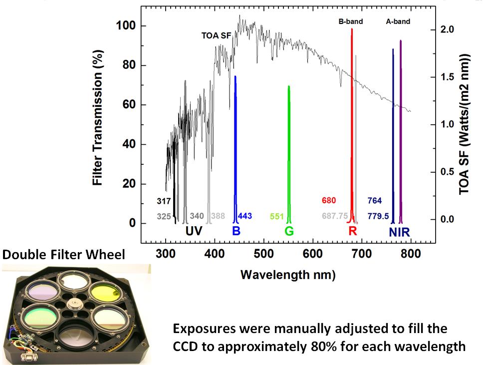
EPIC Filter Wavelength Centers Compared to the Solar Irradiance